Asa Simon Mittman
Cartographies of Exclusion: Anti-Semitic Mapping in Medieval England
Penn State University Press, 2025
232 pages
$109.95
Reviewed by Nina Gary
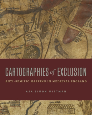
In the preface to this innovative and interdisciplinary work, Asa Simon Mittman includes a truth universally acknowledged among scholars of medieval Jewry: in medieval Christendom, Christian fantasies influenced Jewish realities. Such fantasies as ritual cannibalism, apocalyptic tribes of wandering Jews, and monstrous non-human races haunt the pages of Cartographies of Exclusion. As Mittman points out that the early fourteenth-century Hereford Map—one of the most detailed mappamundi, Latin for “world map,” to come from the period—contains Jewish and Jewish-coded figures in these very fantastic situations, our eye shifts towards the real, disastrous results of these fantasies on Jewish communities in England. But, because the expulsion of the Jews from England preceded the Hereford Map’s production by nearly a decade, Mittman uses his project to advance the scholarly claim that anti-Semitism and anti-Judaism survived and thrived in a post-Jew England, perhaps with more gusto and cartographic moxie than ever. He enters the space of medieval Jewish studies, which he admits is not his own home discipline, with a commitment to centering the medieval Anglo-Jews for whom such cartographic anti-Semitism produced a lived reality marked by violence and subjugation.
Mittman’s first chapter, “On Cartographic Race,” takes its name from a line in Geraldine Heng’s The Invention of Race in the European Middle Ages (2018) that refers to the monstrous races found on the African and Asian periphery of the Hereford Map. Mittman, along with Heng, makes the argument that, whether they knew it or not, medievals were operating within contemporary understandings of race, race-making, and racism. Mittman argues that the Hereford Map cartographically depicts the ‘monstrous’ races, biblical Hebrews (classed in the map as “Iudei” and not “Hebraei”) worshipping the Golden Calf, and a physical separation between England and the map’s racialized bodies. These all contribute to a race-making, nationalizing effort of England’s own: defining whatand whois English, and who, crucially, is not.
In Chapter Two, “Cast Them Out,” Mittman establishes a foundation for conceptualizing the Hereford Map as something that Others Jews, and therefore, as a map which distinctly Anglicizes its Christian viewer by overviewing the operating polities of the last century of Jewish habitation in England. By getting to know Jews closely, English Christians were able to let their preconceived and dehumanizing fantasies run wild, especially as the Jews of Edward I’s time were plunging out of favor and their expulsion became imminent. The Hereford Map’s construction of these fantasies cartographically expels Jews from a geographic notion of Englishness. Mittman writes, “In this construct, Jews could never be English because the English nation is the English people performing their Englishness, whereas Jews were seen as their own nation and therefore, by this logic, could not be included within any other nation.”
Cartographies of Expulsion’s third chapter, “Time, Territory, and Teratology,” smartly unpacks the temporal stagnation of the Jews of the Hereford Map, who are either represented in the biblical past or eschatological future. At the beginning of the chapter Mittman supposes, “The incarceration of Jews within distant regions and times, past and future, is key to their cartographical racialization.” And indeed, as Mittman so discussed in Chapters One and Two, the Jews of the map not only inhabit spaces rendered biblical, and thus ancient, but their temporal situations are “whatever points in history (real or imagined) offer the greatest Christian utility.” Such temporal and geographic distance from the English viewer renders the Hereford Map’s version of the Jews and their actions as something distinctly hell-bound, and thus un-English.
Chapter Four, “The Demon on the Altar,” noting that the Hereford Map’s portrayal of the worshiping of the Golden Calf essentializes Jews, Muslims, polytheists, and idol- and demon-worshipers, and signals an anxiety among the English populace about the “cultural Other.” But beyond pointing to the map’s racial and anti-Semitic fantasies, Mittman discusses the fantasy of Christendom, and thus also of England. Christendom had no set boundaries, no set religion (Al-Andalus, or Muslim Spain, was technically within what we might consider its preliminary borders), no universal rulers, no set currency, no common language; the list goes on. Mittman calls it a “metageographical notion,” and yet the outside threat of the Other, which the mapmakers of Christendom felt so inclined to include in their cartographies, became a physically-represented yet geographically-sidelined set of Muslim-Jew-polytheists worshipping a golden calf named “Mahumet” directly opposite England. Perhaps this is Mittman’s strongest demonstration of cartographic irony: that the mappamundi of the Middle Ages, which were so concerned with the geographic location and temporality of the Jew/Muslim/polytheist/demon-worshiper, never realized a true version of that Other. Instead of producing threats to the Anglo-Christian viewer—like the rumor of ritual murder of the twelfth and thirteenth centuries—these cartographers created bogeymen.
The fifth chapter of Cartographies of Exclusion, “Expelling Jews to the Cold Land of Bizo,” is perhaps the most beguiling to gory sensibilities. In it, Mittman details the apocalyptic fiction of Gog and Magog, hordes of cannibalistic peoples said to become the destroyers of civilization in the end of days. On the Hereford Map, as on other mappamundi, they are depicted outside of a wall supposedly constructed by Alexander the Great, intended to keep them and their horrors out of our world—at least, until the world’s end. These dreaded, violent, apocalyptic people were a reliable figure for the Other in medieval symbology, but Mittman details how this archetypal representation begins to symbolically demarcate other walled-off classes of people. The closed-off Jewries of late thirteenth-century England parallel the enclosure of Gog and Magog.
Closing the book out with Chapter Six, “Power and Paranoia,” Mittman looks beyond the elaborate and illuminated mappamundi that have been the subject of his book, and attends to the simplest T-O models. Of these basic three-sectioned mappamundi, Mittman writes, “These maps, simple and diagrammatic as they are, present the inscription of Christ upon the world, as is often noted, stretching from coast to coast, from one end of the ecumene to the other, touching (and dividing) the three known parts of the world and serving as the organizing principle and rationale for the world’s geographical structure.” With Jerusalem always at the center, and with the cross of Christ covering the entire ground of the world, Mittman argues that the version of the world created by the most basic of T-O maps—even without the dehumanizing images of Jews and Others—is still one “in which there is nowhere left for Jews to live.” And that really is the ultimate, everlasting slap in the face of the most prominent mapping method of the European Middle Ages: that, even without Matthew Paris’s gory details or the Hereford Map’s monstrous races, the world has no place for Jews. By ending on this note, Mittman drags us right back into the present. He forces us to confront, as he did in his introduction, the reality of being Jewish in a world that exudes the exclusion of the T-O map.